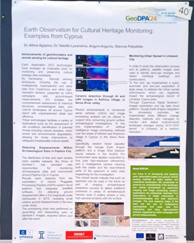
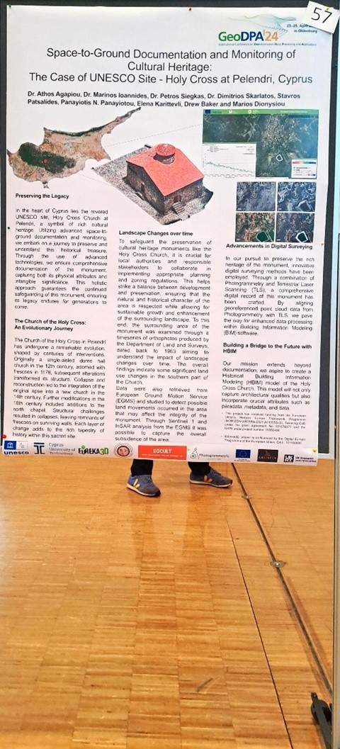
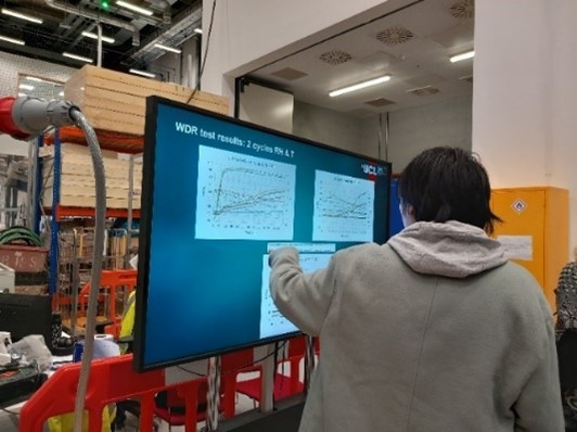
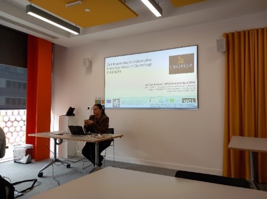
Monthly Archives - April 2024

April 2024

ENGINEER Poster at the DLR International Conference on Geoinformation Data, Processing and Applications – DLR GeoDPA 2024

Following an invitation from the German Aerospace Center (DLR), Stavros Patsalidis, a member of the EOCult Lab at CUT and the ENGINEER project, actively participated in the International Conference on Geoinformation Data, Processing, and Applications (GeoDPA) held from April 23rd to 25th, 2024, in Oldenburg, Germany. He delivered two poster presentations titled "Earth Observation for Cultural Heritage Monitoring: Examples from Cyprus" and "Space-to-Ground Documentation and Monitoring of Cultural Heritage: The Case of UNESCO Site - Holy Cross at Pelendri, Cyprus."...

ENGINEER Workshop III at UCL

Following the initial two workshops hosted by CUT and UAVEIRO, the third workshop of the ENGINEER project convened on April 22-23, 2024 (M18) at UCL premises in London, England. Workshop III (W3), themed "Sensors and Testing for Environmental Characterization of Historic Buildings," featured a diverse array of presentations spanning geomatics, energy efficiency in traditional buildings, forensics, and structural health monitoring in heritage sites and historical structures. Attendees also participated in demonstrations and hands-on exercises. A representative from Geomatrix SME showcased...

IEEE Mediterranean and Middle East Geoscience and Remote Sensing Symposium

The Project Coordinator of ENGINEER Project, Athos Agapiou, and the Principal Investigator of POLIMI, Branka Cuca, have virtually participated today in the 2024 IEEE Mediterranean and Middle-East Geoscience and Remote Sensing Symposium with an oral presentation, acknowledging the ENGINEER project. Cuca B., Agapiou A, The potentials of large-scale open access remotely sensed ready products: use and recommendations when monitoring urban sprawl near cultural heritage sites, 2024 IEEE Mediterranean and Middle East Geoscience and Remote Sensing Symposium, 15 - 17 April 2024

ENGINEER Poster at the CAA Conference at Serres, Greece

A synopsis of activities of the ENGINEER project was provided the Computer Applications and Quantitative Methods in Archaeology (CAA) conference in Serres, Greece organized between 16-17 of April, 2024 by PhD candidate and member of the project, Argyro Argyrou. Argyro presented the poster prepared for disseminating the outcomes of ENGINEER activities at the CAA conference, presenting an overview of the workshops, summer school, trainings and the overall methodology followed. ENGINEER poster drew the attention of conference participants who interacted with...

Argyro Argyrou’s Poster Presentation at the CAA Conference at Serres, Greece

PhD candidate, Argyro Argyrou, presented her research at the Computer Applications and Quantitative Methods in Archaeology (CAA) conference hosted at Serres, Greece between 16-17 of April, 2024. Her research work pertains to the detection of archaeological surface ceramics using very high-resolution remotely sensed data from Unmanned Aerial Vehicles (UAV). Through her PhD research, Argyro also attempts to fill a gap in the current literature by utilizing Artificial Intelligence (AI) methods for detecting non-uniformly distributed surface ceramics in high-resolution remote imagery. Argyrou...

Argyro Argyrou’s presentation at the 3rd Doctoral Colloquium

Argyro Argyrou, PhD candidate at CUT under the supervision of Assistant Professor Athos Agapiou, attended the 3rd Doctoral Colloquium hosted by the University of Cyprus. Argyro presented her PhD research related to ceramic detection from UAV and multispectral imaging. Argyro is using machine learning algorithms and boosting techniques to optimize the overall results. Argyro’s research is directly related to the ENGINEER project which was acknowledged during her talk.

ENGINEER data re-used as class material for Photogrammetry module at CUT (Geomatics BSc)

Prof. Dimitrios Skarlatos has re-used drone imagery, acquired during ENGINEER Summer School I at the Tombs of the Kings over Tomb 7, as class material for the Photogrammetry II module lectured for the needs of Geomatics BSc at CUT.  More specifically, the students are called to process RTK drone photos using Context Capture to produce Orthophotos and Digital Surface Models (DSMs).

ENGINEEER project communicated during the Two-Day Online Informational Seminar for Master’s Level Postgraduate Programs 2024-25

ENGINEER project, along with other research project of the Department of Civil Engineering and Geomatics has been communicated during the Two-Day Online Informational Seminar for Master’s Level Postgraduate Programs 2024-25 event took place today.  Cyprus University of Technology organized a Two-Day, Online Informational Seminar for its master’s degree Programs. These programs have been announced and are currently accepting applications for the September 2024 intake.