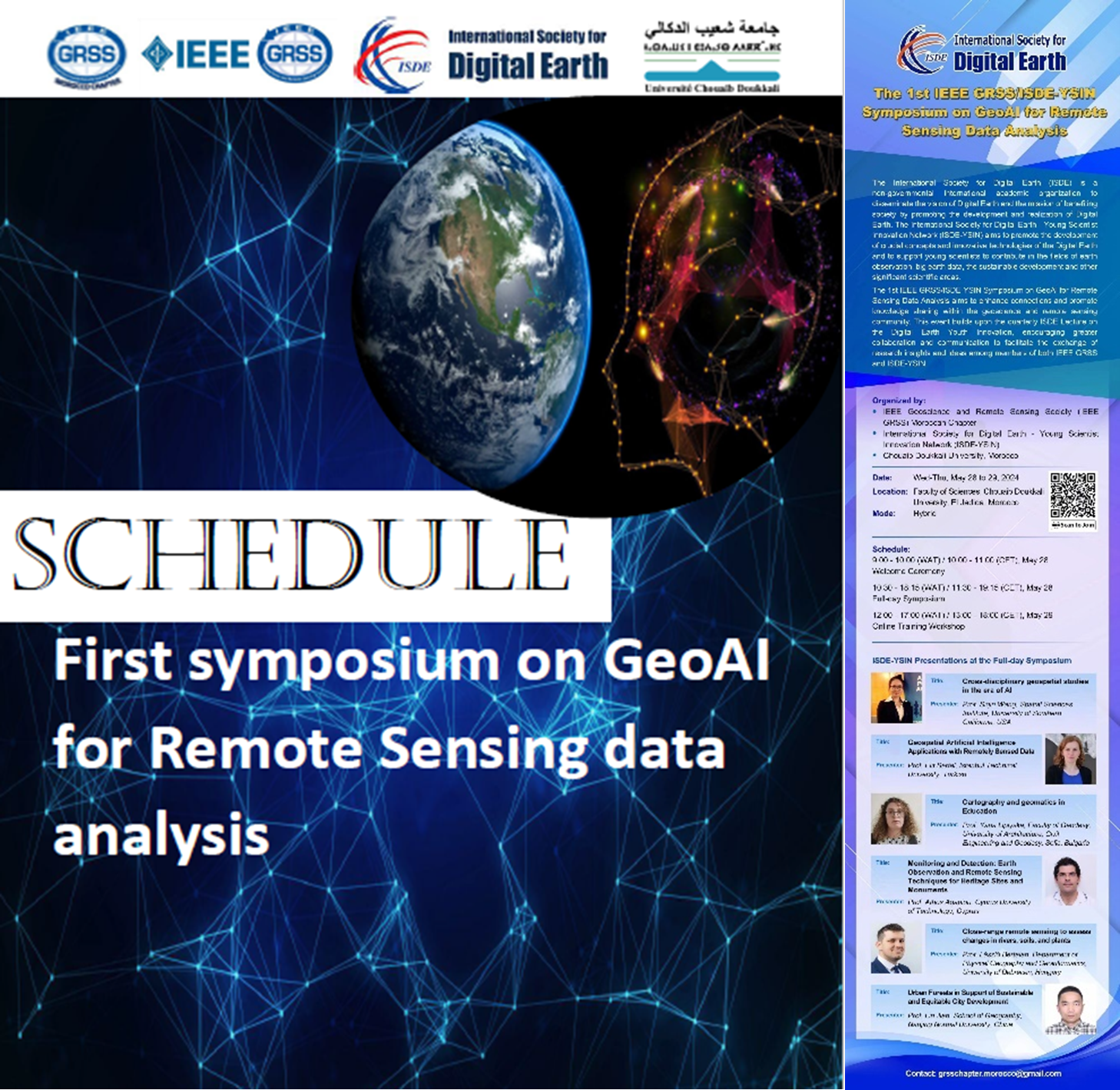
First symposium on GeoAI for Remote Sensing data analysis, by IEEE-YSIN/IEEE GRSS Symposium
The International Society for Digital Earth (ISDE) is a non-governmental international academic organisation to disseminate the vision of Digital Earth and the mission of benefiting society by promoting the development and realisation of Digital Earth. The International Society for Digital Earth -Young Scientists Innovation Network (ISDE-YSIN) aims to promote the development of crucial concepts and innovative technologies of the Digital Earth and to support young scientists to contribute in the fields of Earth Observation, big earth data, the sustainable development and other significant scientific areas
The 1st IEEE GRSSS / ISDE-USIN Symposium on GeoAI for Remote Sensing Data Analysis aims to enhance connections and promote knowledge sharing with the geoscience remote sensing community. This event builds upon the quarterly ISDE Lecture on the Digital Earth Youth Innovation, encouraging greater collaboration and communication to facilitate the exchange of research insights and ideas among members of both IEEE GRSS and ISDE-YSIN.
The event is organized by the IEEE Geoscience and Remote Sensing Society (IEEE GRSS) Moroccan Chapter, the International Society for Digital Earth – Young Scientist Innovation Network (ISDE-YSIN) and the Chouaib Doukkali University, Morocco.
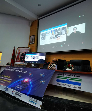
ENGINEER project coordinator, Assist. Prof. Athos Agapiou, was honored with an invitation to deliver a 20-minute presentation at a symposium jointly organized by IEEE-YSIN and IEEE GRSS. In his talk, Dr. Athos Agapiou will present the Cyprus University of Technology as a research organization, and the research projects he is currently involved in, while also exploring avenues for potential collaborative research with members of both esteemed organizations. Athos’ presentation is expected to pioneer future synergies among CUT and institutions from third countries while broadening the network of CUT and the Department of Civil Engineering and Geomatics.