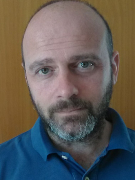
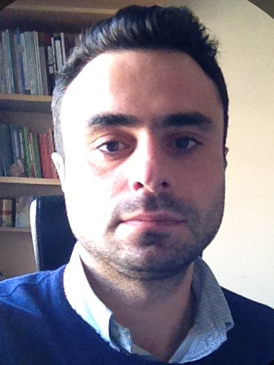
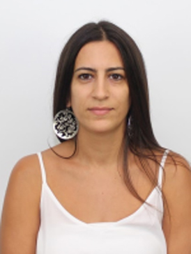
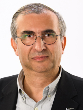
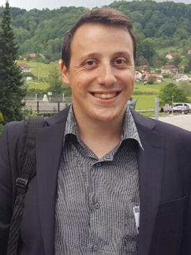
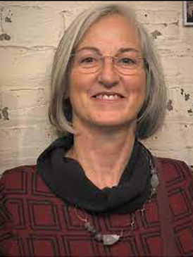
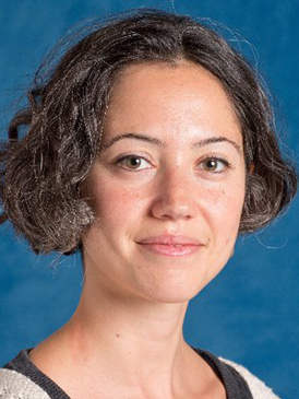
Dr Athos Agapiou obtained his diploma from the School of Rural and Surveying Engineering at the National Technical University of Athens (2005). Two years later, in 2007, he obtained an MSc in Geoinformatics from the same university. Also, he holds an MΑ from the Department of History and Archaeology of the University of Cyprus (2010), while in 2013, he received his PhD in the field of Remote Sensing Archaeology.
Throughout his studies, he has received various awards and scholarships such as from the Alexandros S. Onassis Foundation, the Greek State Scholarship Foundation, the Technical Chamber of Greece, etc. In recent years, he has participated in a number of research projects at European or regional level (H2020, JPI, Interreg), as well as in national research programs funded by the Research and Innovation Foundation (RIF).
From 2021 he is an Assistant Professor in the Department of Civil Engineering and Geoinformatics of the Cyprus University of Technology, holder of the “Geoinformatics and Earth Observation” chair, while at the same time he is the coordinator of the research activities of the EOCult laboratory (Earth Observation Cultural Heritage Lab).
From 2022 he is the Deputy Director of the UNESCO Chair of “Digital Cultural Heritage”. The aim of the UNESCO Chair is to contribute through cooperation with national and international partners to new advances related to the field of digital cultural heritage, aiming to protect and promote cultural heritage.
For his overall research work, he has been awarded the “Young Researcher 2018” award at the annual “Cyprus Research Awards” by the Research Promotion Foundation (RPF). According to a Stanford University study first published in 2020, his name is included in the top 2% of the list of the world’s leading researchers in his particular scientific sub-field.
From 2021 until today he is acting as the National Delegate of Cyprus for the Horizon Europe program (Cluster 4 – “Digital, Industry and Space”), while previously, from 2017-2021, he was the National Delegate of Cyprus of the European Framework Program “Horizon 2020” for “Space”. During the period 2018-2021, he was the chairman of the steering committee of the Greek chapter “Computer Applications and Quantitative Methods in Archaeology” (CAA-GR). Since 2019 he is an evaluator in the NASA Postdoctoral Program (NPP), while he is a reviewer for various European and national funding programs.
From 2022, he is the coordinator of the European project “Civil engineering and geomatics innovative research on heritage” with the acronym ENGINEER, which is funded under the Horizon Europe framework. The ENGINEER research project focuses on the innovative research fields dealing with documentation, digitization, visualization, data exchange, structural design, seismic and conservation engineering of cultural heritage, including monuments and landscapes.
His scientific interests include the fields of Earth Observation and Geoinformatics for archaeological research and cultural heritage landscapes.
More details about his publications in scientific articles and conference proceedings can be found in Scopus, Web of Science, Google Scholar as well as in Research Gate.
Dr. Vasiliki Lysandrou received her PhD in Mediterranean Archaeology from the University of Cyprus in 2014. She holds a three year Diploma di Specializzazione in Restoration of Monuments from the Architectural School Valle Giulia of the University of Rome La Sapienza, a Diploma di Lingua e Cultura Italiana di Livello Superiore from Scuola Leonardo Da Vinci Roma, and a four-year Ptychion (Bachelor) in Archaeology from the Aristotelian University of Thessaloniki. During her PhD studies she was awarded with the prize of “Greek Culture” for the best performance and knowledge on issues related to history, archaeology and generally culture of Greek Civilization. Between 2016-2018 she worked as a Post-Doctoral Fellow at the Archaeological Research Unit of the University of Cyprus, where she studied the tomb architecture and the topography of the Eastern necropolis of Nea Paphos.
Her research interests include the study, survey, and analysis of standing archaeological remains and monuments; aerial archaeology; remote sensing techniques (satellite, middle range and terrestrial) intended for archaeological research; funerary architecture and archaeology of death.
Dr. Phaedon Kyriakidis is a Professor of Geoinformatics at the Department of Civil Engineering and Geomatics of the Cyprus University of Technology (CUT). Prior to this appointment, he was on the Faculty of the Department of Geography at UCSB — Assistant Professor of Geographic Information Science (2001-05), Associate Professor (2005-12) and Full Professor (2012-15), as well as a Professor of Spatial Analysis (2009-15) at the Department of Geography of the University of the Aegean in Greece. He was also an Adjunct Professor (2015-18) and an Affiliated Professor (2018-20) at the Department of Geography of UCSB. Dr. Kyriakidis obtained his BSc (1994) from the Department of Geology of the Aristotelian University of Thessaloniki, Greece, his PhD (1999) from the Department of Geological and Environmental Sciences of Stanford University, USA, with specialization Geostatistics in the Earth Sciences. He also worked as a Post-Doctoral Fellow (1999-2000) at the Hydro-Climate Research Group of the Earth Sciences Division of Berkeley National Laboratory, USA, where he also held a Faculty Staff appointment (2001-13). At CUT, Dr. Kyriakidis has served as the Research Coordinator (2020-21) of the Eratosthenes Center of Excellence, an H2020 funded Excellence Research Centre for Earth Surveillance and Space-Based Monitoring of the Environment, as the Dean (2017-20) of the School of Engineering and Technology, and as a Chair (2016-17) of the Department of Civil Engineering and Geomatics.
Dr. Kyriakidis’s research interests include geostatistics, geocomputation, and geoinformatics, as well as their applications to geographic information science and systems, remote sensing, earth, atmospheric and environmental sciences, public health, and archaeology. He has co-authored more than 70 articles in peer-reviewed scientific journals and has made numerous contributions in conference proceedings and edited volumes. He has co-authored (with Andre Journel from Stanford University) the book entitled “Evaluation of Mineral Reserves: A Simulation Approach”, published in 2004 by Oxford University Press. His publications have received significant attention as attested by the numbers of citations they have received (h-index: 34 at Google Scholar, 29 at Scopus, and 27 at Web of Science, as of June 2022). Dr. Kyriakidis has received a best full paper award (with Rui Zhu and Krzysztof Janowicz from UCSB) for his 2017 AGILE conference paper on quantifying spatial patterns in geographic fields, a best paper award (with Petros Gaganis from the University of the Aegean) in the journal Mathematical Geosciences for his 2013 publication on efficient simulation of (log)normal random fields for hydrogeological applications. He has also been an invited keynote speaker at several international workshops and conferences, such as the “Scale and Spatial Analytics Workshop” organized in February 2020 by the Spatial Analysis Research Center of the Arizona State University in the USA. His research has been funded by the US National Science Foundation, NASA, NOAA, the Greek Secretariat for Research and Technology, and more recently by the European Commission and the Research and Innovation Foundation of Cyprus.
Dr. Kyriakidis has served on the Scientific Committees of numerous international conferences and has reviewed manuscripts and proposals for a wide spectrum of scientific journals and international funding agencies, respectively. He is currently a member of the Editorial Boards of Cartographica (since 2018), and of Spatial Statistics (since 2012). He has served as an Associate Editor for Geographical Analysis (2014-17), a member of the Editorial Board of the International Journal of Geographical Information Science (2007-17), a Board Member of the Hellenic Geographic Information Systems Society (2015-16), as well as a member elect (2018-22) of the Council of the Association of Geographic Information Laboratories in Europe (AGILE). Dr. Kyriakidis was the Chair of the Scientific Committee of AGILE 2019, the 22nd AGILE Conference on Geoinformation Science organized at CUT’s premises in Limassol in June 2019, as well as the Co-Chair of AGILE 2021 (online event). He was also the Chair of the Local Organizing Committee of CAA 2021 (online event), the Annual Conference of the international organization Computer Applications and Quantitative Methods in Archaeology.
Stylianos Hadjipetrou is currently a PhD Candidate in the field of “Geostatistics and Spatial Analysis in Engineering and Geosciences” in the Department of Civil Engineering and Geomatics of Cyprus University of Technology under the supervision of Professor Phaedon Kyriakidis. He holds a B.Eng. from the Department of Planning and Regional Development of University of Thessaly (2015), as well as a M.Sc. in “Spatial Analysis and Environmental Management” from the same Department, with honors.
Stylianos’ main research interests include Geoinformatics, Spatial Analysis and Remote Sensing as well as their applications in geospatial sciences. Through his PhD studies, he has also come to develop a keen interest in geostatistical modeling of geographical variables, along with the relevant applications in engineering and earth and environmental sciences. As a member of Geospatial Analytics Research Laboratory of the Department of Civil Engineering and Geomatics at Cyprus University of Technology (CUT), Stylianos is involved in projects relevant to the fields of geostatistics and spatial analysis. Stylianos utilizes his inter-disciplinary background and well-developed spatial thinking skills to face spatial challenges from multiple points of view.
Stylianos has teaching experience in GIS-related undergraduate courses as a teaching assistant and has also worked in the private sector for more than 2 years as a town planner and GIS Specialist. Stylianos is also among the recipients of the Cyprus State Institution (IKY) Scholarship for PhD studies (2017-2020) and a Swiss Government Excellence Scholarship (FCS) holder for the academic year 2020-2021. Stylianos is a member of Scientific Technical Chamber of Cyprus (ETEK) since November 2016.
Dimitrios Skarlatos is Associate Professor in the department of Civil Engineering and Geomatics in Cyprus University of Technology, currently he serves as the Vice Dean of the Faculty of Engineering and Technology, while in the past he served as department’s Vice Chair. He holds a Dipl. Eng. in Rural Surveying from National Technical University of Athens (NTUA), M.Sc. with distinction from University College London (UCL) and a Ph.D. from NTUA in digital photogrammetry. During his studies, he earned scholarships and awards, including ‘Diomedes Komninos’ award from NTUA, ‘Hotine Exhibition Award’ from UCL, ‘Prize in Photogrammetry’ from Royal Institute of Chartered Surveyors (RICS, UK), ‘Lambadarios’ scholarship (after written exams) and ‘Lambadarios’ Award (highest GPA in geodetic classes) from Athens Academy, scholarship from National Scholarship Foundation, ‘Best diploma thesis award’ from Technical Chamber of Greece, and a short scholarship from EuroSDR (European Spatial Data Research Network). He is member in several professional and scientific committees. He has served as member of board in Hellenic Society of Photogrammetry and Remote Sensing (2003-2019), and Vice President of Cypriot Association of Rural and Surveying Engineers for one term (2014-2016). He is the academic representative of Cyprus in EuroSDR (since 2010) and co-chair in International Society of Photogrammetry and Remote Sensing, Commission II (2016-2020), Working Group 9, about underwater photogrammetry.
For 12 years he worked as free-lance land surveyor in Greece, court expert and technical consultant in geoinformation companies in nationwide projects. During that period he participated as well as in research projects (3 European Research and Innovation Projects, 5 national from General Secretariat for Research and Technology) for archaeological site and monument recording, copies of museum exhibits, real time quality control applications using machine vision, AUAVs for mapping.
During his post in CUT, he has participated or coordinated in research projects with UAV mapping (HawkEye, ArcheoPhoto), UAV coastal mapping and bathymetry (SARCOS, Archaeological Survey on the new marina of Ag. Napa), Parthenon frieze precise 3d modelling (Digitizing Parthenon Frieze), ROV mapping (AQUABOT), mobile mapping platforms (CUT, starting grant), satellite imagery processing (CASCADE, RISKA, SpotOnAcacia). All projects had funding from EU Horizon 2020, EU FP 7, European Regional Development Fund (ERDF), European Union’s ERC, Promotion Foundation of Cyprus, Electricity Authority of Cyprus, Honor Frost Foundation, Dept. of Antiquities of Cyprus. He is currently lead coordinator of iMareCulture, a H2020 2.7M research and innovation grant, for underwater VR museums, with 11 partners from Europe and Canada. He is PI of CUT in MOBILO project (funded by RPF), for developing a low cost mobile mapping system. He is the lead surveyor in Mazotos shipwreck, underwater excavation, since 2010, Nisia excavation since 2014 and Protaras shipwreck since 2019. He is also developing a micro deformation monitoring system for civil engineering laboratory material and construction analysis.
His main research interests focus on the acquisition and processing of 3D data and point clouds using image sequences. This includes underwater, UAV or close-range photos. Apart from image-based techniques, 3D data acquisition is extended using handheld or terrestrial laser scanning.
Nicholas Kyriakides is a Lecturer at the Civil Engineering and Geomatics Department of the Cyprus University of Technology (was appointed as a full-time Post-Doctoral Researcher at the University since 2008). He holds a PhD in the field of “Earthquake Risk Assessment of RC buildings” from the Department of Civil and Structural Engineering, University of Sheffield with an Oversees Student Award Scholarship and a Scholarship from the A. G. Leventis Foundation in Cyprus. He also holds a 1st class BEng degree with Honours from the University of Nottingham. His research interests include the assessment of existing RC buildings under seismic loading and the enhancement in response after conventional and innovative retrofitting. He has participated in both European and locally funded projects concerning the seismic risk assessment of structures in Cyprus and the Middle East. The main areas that are covered by his research is the damage propagation and response of existing Reinforced Concrete (RC) buildings subjected to seismic loading and other dynamic actions before and after retrofitting, and the simulation of the experimental results using numerical FE analysis. Life-cycle cost analysis is also used as a tool to obtain the optimum retrofit level. Recently he has worked on the correlation of damage condition mapped in underground sepulchral monuments with historical seismic activity in the area using non-linear FE analysis on a simulation 3D model of a case study tomb (Tomb 4 in Tombs of the King).
Further to his research activities he is very active in policy making committees. Indicatively he has been formally appointed through an evaluation process as a Moderator of the Group for the Protection of Critical Energy Infrastructure (PCEI) of the European Defence Agency, as a Member of sub-committee CYS TC 18-Eurocodes for EC8, a Member of the Committees for the Assessment of Existing Buildings and for Research of the Cyprus Scientific and Technical Chamber (ETEK) and an External expert for the NAT/750-EESC study group to Strengthen EU’s civil Protection response –rescEU. The latter one involves the review of the Commission’s proposal for a new Mechanism for Civil Protection for Europe and enriches his experience and knowhow on the topic of National Risk Assessment for Natural and Technological Hazards.
His strong involvement in National Risk Assessment is also obvious from his appointment as the coordinator of the National Risk Assessment (NRA) Study for Cyprus, which involves the assessment of ten hazards both natural and technological. The appointment was after a competitive tendering process managed by the local Civil Defence authority. His contribution to the Risk Assessment and disaster response is also complimemted by his involvement in the formulation of the ‘Egelados plan” concerning the response after earthquake events and his participation in a number of table-top and field exercises for the implementation of the plan for various scenarios. On the topic of risk assessment for natural disasters, he also acted as the assistant Team Leader in a project for the preparation of an Evaluation report for Strengthening Disaster Risk Management Capacities in Lebanon, which was funded by UNDP and followed the Sendai framework. In 2019 he also coordinated the drafting of the Strategy for Disaster Risk Reduction (DRR) for Cyprus, which is based on the SENDAI framework of the United Nations and recommends that a holistic approach including the development of a legal basis and clear distribution of responsibilities could enhance DRR in Cyprus along with the establishment/appointment of a coordinating agency with responsibility and function to facilitate the inter-agency/multi-stakeholder cooperation process to develop the NRA and DRR strategy.
Dr Renos A. Votsis is a Research Fellow in the Department of Civil Engineering and Geomatics. He received a Higher National Diploma in Civil Engineering from the Higher Technical Institute (Diploma, First Class). He continued his studies at the University of Surrey (UK) to obtain Bachelor of Engineering (BEng Honours, First Class) where he received the department’s scholarships for his HTI performance. During that period he was awarded the Institution of Civil Engineers (ICE) UK prize for the best graduate and the Felix Pulzer Memorial Prize 2001 for the best Performance in Civil Engineering courses. He then studied for a PhD with a scholarship from the University of Surrey and the ORS, in the area of dynamic analysis and damage identification in fibre reinforced polymers (FRP) structures using non-destructive testing (NDT) methods and damage identification techniques (DIT). After receiving his PhD, he worked for the UK consulting firm Tony Gee and Partners (TGP) in the Special Projects Group; TGP at that time, has been awarded many prizes including “Best medium size Consultant in the UK” (2008) and “Best places to work” (2009).
Dr Votsis is a member of the Cyprus Scientific and Technical Chamber (ΕΤΕΚ).
His research interest include: Dynamic analysis/testing, FE modelling, Damage and condition assessment and structural health monitoring (SHM).
Education: Argyro Nisantzi has a PhD in Remote Sensing for Atmospheric Studies from Cyprus University of Technology. She graduated from the Department of Physics of the National and Kapodistrian University of Athens (NKUA) and she finished her Master degree in Environmental Physics and Meteorology of the NKUA with distinction.
Professional background: Dr. Argyro Nisantzi had worked as a research assistant in the Department of Environmental Physics and Meteorology of the National and Kapodestrian University of Athens (2006-2008). From 2009 up today she is research scientist at the ERATOSTHENES Research Centre and she has participated in many research projects on National and European level which have as main research field the atmospheric studies using remote sensing techniques (FP7-BACCHUS, HORIZON2020-GEO-CRADLE, RPF-AIRSPACE, WEBAIR-2, FP5-LIFE) as well the impact of air pollution on sites of cultural heritage (HORIZON 2020 ATHENA, JPI-CLIMA). The last years she has been involved in three international scientific experiments in the CY-CARE (Cyprus Cloud Aerosol and Rain Experiment), which is a global novelty in the study of the effect of dust particles on cloud formation and climate change, in the A-LIFE, aiming at exploring the properties of absorbent aerosols in the Eastern Mediterranean and in the COVID-19 NRT lidar measurement campaign for studying the changes in the atmosphere during the COVID-19 lockdown.
Research: Dr. Argyro Nisantzi has participated in National and European research projects as mentioned above and her main research interests comprise the study of the atmosphere using laser techniques and passive remote sensing systems for characterizing aerosol optical properties in the Atmospheric Boundary Layer and the Free Troposphere. Dr. Argyro Nisantzi has 16 publications at scientific journals (h=9) and more that 30 oral/poster presentations at international conferences.
Alexandros Pantelides holds a BSc (First Class Honors) and an MSc (Merit) in Paleobiology from UCL and University of Bristol, respectively. He holds an MSc in Oil and Gas Technology (Distinction) from the Technological Educational Institute of Eastern Macedonia and Thrace (which since has become part of the International Hellenic University). He is currently a PhD candidate working on “Spatial Analysis in Paleobiogeography” under the supervision of Prof. Pheadon Kyriakidis.
Alexandros’s research focuses on mechanistic simulations of paleobiogeographic patterns and processes of ancient animals and humans through the use of Agent-Based Modeling. He also uses a blend of spatial analytic and geostatistical methods, as well as analytical modeling of thermo-physiology and locomotion energetics. Moreover, he is interested in using computational fluid dynamics to solve problems related to aquatic locomotion of living organisms.
His goal is to make regional and global scale inferences on the macroecology and biogeography of life in the past, through a combination of the aforementioned tools and methods.
Giorgos Kafataris is a graduate Surveyor Engineer and Geoinformatics Engineer of Cyprus University of Technology. Upon completion of the undergraduate degree, he continued with a full scholarship to the postgraduate program in Geoinformatics and Geospatial Technologies at the same university. From his studies he acquired the basic theoretical knowledge in surveying engineering, geographic information systems, remote sensing, and photogrammetry.
In the BSc thesis he dealt with the creation of point cloud from aerial images and a comparison was made with LiDAR elevation data. In the MSc thesis he dealt with the comparison and fusion of UAV and TLS data, to create a 3D photorealistic model of Amathus Roman Baths. As part of his MSc thesis he was involved in the writing of a scientific article entitled “FUSION OF DIRECT GEOREFERENCED AERIAL DRONE WITH TERRESTRIAL LASER SCANNER DATA. THE CASE OF THE ROMAN BATHS OF AMATHUS, CYPRUS” in collaboration with professor Dimitrios Skarlatos and the PhD candidate Marinos Vlachos, which was presented at the Geospatial Week conference of the International Society for Photogrammetry and Remote Sensing (ISPRS) in Cairo in September 2023.
Argyro Argyrou is a PhD candidate at the Department of Civil Engineering and Geomatics at the Cyprus University of Technology. Her research interests include Spatial Analysis, Cartography, Artificial Intelligence, Earth Observation and Geoinformatics for intended for archaeological research and cultural heritage landscapes.
She obtained a diploma as a Graphic Arts Technologist at the University of Western Attica and an MSc IN GIS at the University of Leeds – School of Geography where, as part of her thesis, she dealt with the spatial analysis of hereditary genetic diseases in Cyprus (“THE GENETIC HERITABLE DISEASES IN CYPRUS – A SPATIAL ANALYSIS APPROACH”). As an alumnus of the University of Leeds she participates in the Mentoring Scheme of the University with the aim of guiding new students in the field related to Geoinfomatics. At the same time, she is a member of the User Community for Geospatial Authorities as well as at the Earth Observation Cultural Heritage Research Lab of the Cyprus University of Technology.
As part of her PhD, she participates in the program “Innovative survey techniques for detection of surface and sub-surface archaeological remains”, in short ENSURE of the Cyprus University of Technology under the guidance of her supervising professor Athos Agapiou.
Marinos Vlachos is a PhD Candidate and a researcher in the Photogrammetric Vision Lab. He holds an M.Sc. in Geomatics Engineering and Photogrammetry from University of Stuttgart. He also holds a bachelor’s degree in Surveying Engineering and Geomatics, from the Cyprus University of Technology. During his studies he earned a distinction for his Diploma Thesis entitled “Dense Image Matching for High Precision Digital Surface Model Accuracy through UAV flight patterns”, and published a paper entitled “Investigating Influence of Unmanned Aerial Vehicle Flight Patterns in Multi-Stereo View DSM Accuracy” that was presented in the SPIE Optical Metrology 2015 conference in Munich Germany. Currently he is working on his Master Thesis as he completes his studies at University of Stuttgart. Furthermore, his research often deals with the creation of accurate 3D models through Structure from Motion both from aerial and underwater imagery as well as the integration of various cameras (RGB and MS) with UAV platforms since his Master Thesis was dedicated to that topic. During his PhD Marinos is engaged with the topic of colour correction of underwater images and the impact it has in 3D Reconstruction and Visualization.
Stavros Patsalidis holds a bachelor’s degree in surveying and Geoinformatics Engineering as well as a master’s degree in Geoinformatics and Geospatial Technologies with first class honors from the Department of Civil and Geomatics Engineering of the Cyprus University of Technology.
As part of his diploma thesis, for which he was awarded the 3rd place prize in the “Students in Research – FOITO 2018” competition organized by the Research Promotion Foundation, he dealt with the performance and sensitivity evaluation of machine learning algorithms (Random Forest) applied in time series analysis applications of Sentinel-2 and Landsat-8 satellite images, for land use/cover mapping. As part of his master’s thesis, he also used machine learning algorithms (hybrid simulation method Cellular Automata – Artificial Neural Networks), to model the rate of changes in the landscape over a period of 30 years and simulate expected changes (Land Use/Cover Change) in the future.
His research interests focus on the analysis of multispectral / hyperspectral satellite images and the development and application of remote sensing methods for the systematic monitoring and mapping of the natural and built environment.
Today, he is a Special Scientific Associate, a member of the team of Dr. Athos Agapiou at the Earth Observation Cultural Heritage Lab of the Cyprus University of Technology and participates in the program “Innovative survey techniques for detection of surface and sub-surface archaeological remains”, for applications that focus on the long-term observation of monuments and archaeological landscapes.
During the period 2016-2018, he collaborated with HERE Technologies B.V., as an expert – community member (Data Acquisition Specialist), aiming to continuously update HERE’s geographic database and navigation maps.
Also, in 2017, he was trained in ArcGIS softwares (ArcMap, ArcGIS Pro, ArcGIS Online) by the Marathon Data Systems, where he focused on the development of online maps and applications to promote the actions of the Greek government for the Integrated Management of Marine and Internal Waters.
In 2019, he worked as a Research Associate in the Department of Environmental Science and Technology of TEPAK, for AIGIS – Interreg project, with the aim of developing a cross-border intelligent system for resource management, decision-making and training to deal with natural and technological disasters, man-made and social crises.
Also in 2022, he worked as a Technical Engineer / GIS Administrator in the Department of Urban Planning and Housing / Computerization Branch, where he was responsible for the geographical data management of “IPPODAMOS” System, the development of new applications to support the department’s GIS functions, the drafting technical reports, texts and manuals related to GIS applications and the technical support of GIS users.
Kyriakos Michaelides is a Research Associate and member of the research group of Dr. Athos Agapiouand is currently pursuing his MScdegree in Geoinformatics and Earth Observation at Cyprus University of Technology on a full scholarship from the university. He holds a BSc in Surveying and Geoinformatics Engineering from the Department of Civil and Geoinformatics Engineeringfrom Cyprus University of Technology. During his studies at the CUT he has been awarded for his high performance and has been awarded the first graduate of the Survey and Geoinformatics Engineering course. During his degree he created a StoryMapfor the Municipality of Kyrenia through ArcGIS softwaresentitled Christian Monuments of Kyrenia District.
His research interests focus on Satellite Remote Sensing, Geographic Information Systems and CultureHeritage, he has worked as a surveyor engineer focusing on Topography and he is a member of the Cyprus Scientific Technical Chamber (ETEK).
Dr. Orestes Marangos was born in Nicosia, Cyprus and is a Research Fellow in the Department of Civil Engineering and Geomatics of the Cyprus Institute of Technology (CUT).
Orestes began his studies at the Higher Technical Institute in Cyprus where he earned the Diploma of Technician Engineer in the field of Civil Engineering. He continued his education in the United States of America and earned his B.Sc. and M.S. degrees from University of Missouri-Kansas City in 2002 and 2004 and his Ph.D. degree from the University of Kansas (with honors), in Civil Engineering in 2010.
Orestes’ doctoral dissertation was centered on the non-destructive characterization of the dentin structure relevant to composite restorations, using scanning-acoustic microscopy.
His research interests include ultrasonic wave propagation modelling of heterogeneous substrates such as metal foams and biomaterials, quantitative scanning acoustic microscopy and numerical methods for ultrasonic field computations that arise from acoustic objectives lenses. At present, he is applying experimental testing methods to study the mechanics and fracture of composite materials reinforced with carbon fabrics.
So far, he has published a significant number of peer-reviewed articles in journals and conference proceedings and several presentations in international conferences in the aforementioned research areas. Orestes is a current member of the Technical Chamber of Cyprus (ETEK) and has been a member of professional organizations such as: the American Society of Civil Engineers (ASCE), the American Geophysical Union (AGU) and the International Association for Dental Research (IADR) He is also a member of Tau Beta Pi (2002) and Chi Epsilon (2008) honor societies.
Branka Cuca, born in Belgrade, has received her bachelor degree in Architecture at the Politecnico di Milano in 2003, where she has obtained a master’s degree in Architecture (2006). In March 2010 she has earned a title of PhD in Geomatics and Infrastructures. From 2013 to 2016 she has collaborated with Remote Sensing Lab at the Cyprus University of Technology (CUT). Since 2017 she is an Assistance Professor in Topography and Cartography, while it is since 2011 that she has been teaching courses in surveying, in Italy and abroad.
Her research activities regard the geometric documentation and valorization of cultural heritage with focus on terrestrial photogrammetry and geo-spatial data management. Cuca has been involved in a number of international projects in Italy, Serbia, Albania, Belgium and Cyprus, collaborating with many universities across Europe. Since 2012 she is a member of international organizations ICOMOS and CIPA, while since 2013 she acts as a co-chair of the Working Group Earth Observation/Copernicus of the European network NEREUS (Network of European Regions Using Space Technologies).
Born Domodossola, Northern Italy, 21st December 1981. He received a bachelor’s degree in Civil Engineering in July 2004 and a master’s degree in Civil Engineering (Surveying and Monitoring) in December 2006. In February 2011 he received a PhD cum laude in Geomatics and Infrastructures at Politecnico di Milano.
His research activities are based around:
He has had numerous papers published (more than 130). He has held, or taken an active part in several conferences on the topic of engineering surveying, cartography, remote sensing, photogrammetry and laser scanning.
Daniela Oreni, architect. She obtainedin 2008 a Ph.d. in Conservation of Architectural Heritage and a post-graduate degree at the School of Conservation of Architectural and Landscape Heritage of Politecnico di Milano in 2010. She has been assistant professor since 2014 and she has taught in the course of Innovative surveying technologies, Urban and Environmental Surveyat Polimi since 2001.She is expert in heritage survey and documentation, cataloguing and digital technologies applied to cultural heritage.
Graduated in Civil Engineering at the Milan Polytechnic in 2007, he obtained the specialist degree in Civil Engineering in 2009. In March 2014 he obtained the PhD in Environmental and Infrastructure Engineering with a Geomatics profile at the Milan Polytechnic.
Since 2011 he has been a member of Lab. Dabc – GIcarus section (head Prof. Raffaella Brumana).
The research activities concern:
Author of over 100 scientific publications, he has participated as a speaker at numerous conferences both nationally and internationally. He has participated in various research projects at European (FP7, CIP, H2020) and national (ERDF) level.
Dr. Kyriacos Themistocleous is a Senior Researcher at the Cyprus University of Technology. He has a great deal of experience in research and development, as well as having been involved in over 30 European funded projects (including HORIZON 2020, FP7, FP6, LIFE+, ERASMUS+, MED, INTERREG, EUREKA, JPI, etc) as well as national funded projects, including the Research Promotion Foundation. He is the Project Manager of the EXCELSIOR project for the creation of the Centre of Excellence in Earth Observation (H2020). As well, he is the national representative for the Copernicus User Forum, the Copernicus Cultural Heritage Task Force, the Copernicus Relay Network and the Copernicus Academy as well as the expert-representative for ICIP (Interpretation and Presentation of Cultural Heritage Sites)
Dr. Kyriacos Themistocleous graduated from the University of Louisiana with a 5 year degree in Bachelor of Architecture, followed by a 2 year Masters of Architecture in Urban Design from the University of Oklahoma. He received his Ph.D from the Cyprus University of Technology. He has completed his post-doctorate in Marine Spatial Planning. His experience and research interest include remote sensing, geomatics, Earth observation, GIS development, architecture, urban planning, life cycle cost, cultural heritage and environmental applications. Currently, he has over 280 publications in peer-reviewed journals, book chapters and conference proceedings with over 1,000 citations. He has participated as chairman in several international conferences as well as reviewer and editor for several scientific journals. As well, he is a reviewer for European research projects for the European Commission. He is the Chair of the Organizing Committee of the International Conferences of Remote Sensing and Geo-information.
Dr. Themistocleous is President of the Cyprus Remote Sensing Society, Executive Council member of the Technical Chamber of Cyprus (ETEK) and treasurer of the Cyprus branch of the International Council on Monuments and Sites (ICOMOS). He is also a member of the Cyprus Architect Association, American Institute of Architects (AIA), the National Council of Architecture Registration Board (NCARB), the Architecture Honors Society and the International Society for Optics and Photonics (SPIE). He is a licensed architect in Cyprus and the United States as well as a Qualified Expert on the Energy Performance of Buildings for the Energy Service of the Ministry of Commerce, Industry and Tourism in Cyprus. He participated in the special committee of the Minister of Transport, Communications and Works, Cyprus for Space, in relation with the European Space Agency.
Georgios conducted both his bachelor (BSc.) and postgraduate (MSc.) studies at the Dept. of Cultural Technology and Communication, University of Aegean. During his studies at the University of Aegean, he started his research career as research associate at the Intelligent Multimedia and Virtual Reality research laboratory, focusing on Artificial Neural Networks (ANNs).
He is currently a PhD candidate at the Department of Civil Engineering and Geomatics at Cyprus University of Technology (CUT), supervised by Prof. Phaedon Kyriakidis and co-supervised by Prof. Diofantos Hadjimitsis and Ass. Prof. Chris Danezis. Georgios has received scholarship for his PhD studies, awarded by the Cyprus State Scholarships Foundation (IKYK) Scholarship.
In the past, he was awarded a Marie Sklodowska-Curie fellowship as part of the “Initial Training Network on Digital Cultural Heritage” (ITN-DCH) project. During his studies at CUT he is employed as a researcher in several National and European -funded projects relevant to his fields of expertise, while additionally, he participates in research proposals writing.
Georgios’ research interests are mainly focused on Spatial Analysis, Agent-Based Modeling, Geostatistics, Big Data, Data Mining, Neural Networks and Cultural Heritage, therefore he is expected to contribute with his expertise to the ERATOSTHENES Centre of Excellence at the departments of Big Earth Data Analytics and Resilient Society.
Currently, the main scope of Georgios’ research lies in using Agent-based Models to study emerging phenomena such as mobility; the movement of humans and animals in space to understand patterns or reasons that could possibly be hidden behind such mobility (pedestrians, migration, epidemics such as COVID19, trade, etc.) or even to assess human responses during an emergency, thus acting in such way as tools for optimizing any existing urban or building evacuation plan. These models, especially intelligent agents, are part of the Artificial Intelligence (ΑΙ). They have grown dramatically in the last decade through their use in a wide range of disciplines that extend but are not limited to land use, urban systems, geospatial analysis, supply chain, health, sociology, economics. In addition to the above, Georgios through his employment in the department of Big Earth Data Analytics, among others he conducts research on predictive modeling, statistics and analysis tools, as well as he depthens his existing knowledge in data mining and machine learning techniques.
The outcomes of his ongoing research work are published in the form of a book chapter, as well as in several research papers submitted at conferences.
Georgios acted also as an external research associate at the “Sustainable Island Futures: Comparing Small Island States and Subnational Island Jurisdictions: Towards Sustainable Island Futures” project funded by the Social Sciences and Humanities Research Council of Canada (SSHRCC) in collaboration with the Dept. of Geography at the University of Aegean. It is worth mentioning that Georgios also served as Vice-Chair of the Marie Curie Alumni
Association Cyprus Chapter (MCAA-Cy). Georgios showcasing great interpersonal and organization skills has co-organized successfully several international conferences like EuroMed 2016 held in Nicosia (Cyprus), the 22nd AGILE Conference on Geoinformation Science organized in Limassol (Cyprus) and the CAA 2021 “Digital Crossroads” held online on 14-18 June; the 48th Conference of Association’s for Computer Applications and Quantitative Methods in Archaeology, where he also acts as proceedings editor. Currently, Georgios is co-organizing the Earth Observation for Environmental Monitoring – 41st EARSeL Symposium, both to be held in September 2022, Cyprus.
Georgios has also teaching experience in spatial analysis-related undergraduate courses in his capacity as teaching assistant.
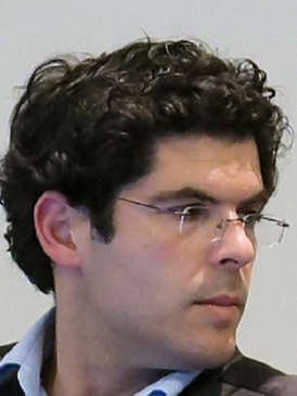
Alice Tavares is an architect (FAUP, 1993), Researcher at the RISCO Research Unit – University of Aveiro (UA), Invited Assistant Professor at the Department of Civil Engineering at the UA (Heritage Rehabilitation Course) and post-doctoral fellow at the Foundation for Science and Technology (FCT) since 2015. He holds a PhD in Civil Engineering at the University of Aveiro (UA) in 2015 within the scope of Integrated Strategies for the Rehabilitation of Built Heritage, having carried out research at the University of Bath (UK) under the guidance of Prof. Dina D’Ayala (2010). She advises doctoral (Lebanon), post-doctoral (Brazil) and master’s (Portugal) students. She is the author of books, book chapters and articles on Heritage Rehabilitation, earth construction and collaborates as a researcher in national and international research projects and with technical teams from the UA of building inspection. She was president of the Board of Directors of the Núcleo de Arquitetos de Aveiro (1999-2005), worked as an architect between 1993 and 2010, was a Research Fellow at FEUP between 2011 and 2015. She has coordinated and participated in Organizing and Scientific Committees of national and international conferences and coordinates protocols between DEC-UA and Portuguese municipalities and foreign entities. She is currently Member of the National Board of Directors of the Order of Architects, is Coordinator of the Sísmica Group of the Order of Architects, is President of the Portuguese Association for Urban Rehabilitation and Heritage Protection (APRUPP), is President of CICOP.Net Portugal (Florence, Italy) and member of the organizations Portuguese Society of Earthquake Engineering (SPES) and European Center for Urban Risks (CERU). Participates in the COST Action TD1406 –Innovation in Intelligent Management of Heritage Buildings. She is a researcher in the following projects: “SafEarth: Seismic protection of earthen construction heritage”; CemRestore, funded by FEDER – COMPETE – FCT funds (2018-2020); Seismic-V: Vernacular seismic culture in Portugal (2013-2015).
Dina D’Ayala is the Professor of Structural Engineering at University College London, within the Department of Civil, Environmental and Geomatic Engineering. She is head of Civil Engineering and Co-Director of the Earthquake and People Interaction Centre, EPICentre. She is a director of the International Association of Earthquake Engineers and Fellow of the ICE. Her specialism is Structural Resilience Engineering with particular emphasis on the assessment, strengthening, preservation and resilience of existing buildings, structures, transport infrastructure and cultural heritage. Her current research focuses on resilience of structures and infrastructure to natural hazards, supported through research grants from EU FP7, INFRARISK, and the UK RC, PARNASSUS, STORMLAMP, SCOSSO, PRISMH. She has 25 years’ experience working with international agencies, the World Bank, ODA, UNDP, British Council, in countries such as Nepal, Jordan, Turkey, Iraq, Philippines etc., and leading interdisciplinary projects on enhancing resilience against natural hazards. She has produced Guidelines for DfID on assessment and strengthening of hospitals and reconstruction efforts in Nepal. She is the chief scientist for the World Bank on the Global Programme for Safe Schools (GPSS) and leads the development of the World Bank GLoSI project.
Research milestones include the development of a numerical procedure to determine the seismic vulnerability of masonry dwelling (FaMIVE) with application from Turkey to Nepal, to Iran and Italy, the design and development of two patented strengthening dissipative devices, to retrofit architectural heritage and limit damage from seismic shocks.
She teaches Structures, Earthquake Engineering, Conservation Engineering and Design to Civil Engineering and Architecture students at undergraduate and postgraduate level.
Profile
Academic Background
2011 PhD Conservation of Architectural Heritage Middle East Technical University, Ankara
2006 Msc Archaeometry Middle East Technical University, Ankara
2003 Bsc Civil Engineering (Structures) Middle East Technical University, Ankara